
Physical Maps


Physical Maps
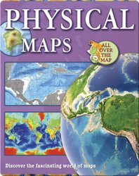
Maps are like a gateway to the world! They help find things like libraries and museums in cities across the globe. Have you ever tried using physical maps? Have you ever wondered which country has the most lakes? Or where the highest point in your state is? Physical maps show landscape features and also use their own color codes to show various elements of the planet. Learn why physical maps are useful and how they help guide lost travelers. The ‘Physical Maps’ book is extremely useful for young readers who wish to understand geography with images. Ideal for kids in the age range of 8-11 years, ‘Physical Maps’ book is perfect for book club sessions and also helps understand directions and geographic diversities.
About This Book
By: Ellen Rodger
Illustrated by:
Published by: Crabtree Publishing Company
8-11Age Range
5.1AR
30Pages
Learning ConceptsSubject
IG830LLexile
15-30 minsReading Time
RGuided Reading
RFountas & Pinnell
40DRA